Parks and Reserves
Here Natute is protected
Parks and Reserves
Here Natute is protected
he presence of a National Park, a Regional Park, numerous Nature Reserves and two UNESCO recognitions – the Geopark of the Apuan Alps and the MAB Biosphere Reserve of the Tuscan-Emilian Apennines – testifies to the rich environmental, naturalistic and historical heritage that characterizes the Garfagnana and the Serchio Valley.
Established in 1985, the Regional Park of the Apuan Alps includes the mountainous complex that extends for approximately thirty kilometers in a North-East, South-West direction parallel to the Tyrrhenian coast. The pyramidal cusp of Pisanino, with its 1947 m, is the highest peak of the chain, but each peak has its own shape that distinguishes it and its own legend, the traditions here are still strongly felt, spend a few days of holiday in one of the many small inhabited centers or simply walking along the paths marked by the CAI to reach a welcoming refuge near the top, can leave unique sensations, you can truly fall in love with these mountains.
Established in 2001, the Tuscan-Emilian Apennines National Park includes the Orecchiella Nature Reserves. The wooded ridges that separate Tuscany from Emilia Romagna give way to a true mountain environment. Here there are peaks that exceed 2000 metres, the forests give way to rocks, lakes and prairies. Further down, on the Emilian side, the Pania di Corfino stands out.
In 2015, UNESCO, recognizing the focal role of the Euro-Mediterranean climate frontier in this part of the northern Apennines, established the MAB (Man and the Biosphere) Reserve, for the Tuscan area the municipalities of Barga, Castelnuovo di Garfagnana, Castiglione di Garfagnana, Coreglia Antelminelli, Fosciandora, Minucciano, Piazza al Serchio, Pieve Fosciana, San Romano in Garfagnana, Sillano Giuncugnano, Villa Collemandina.
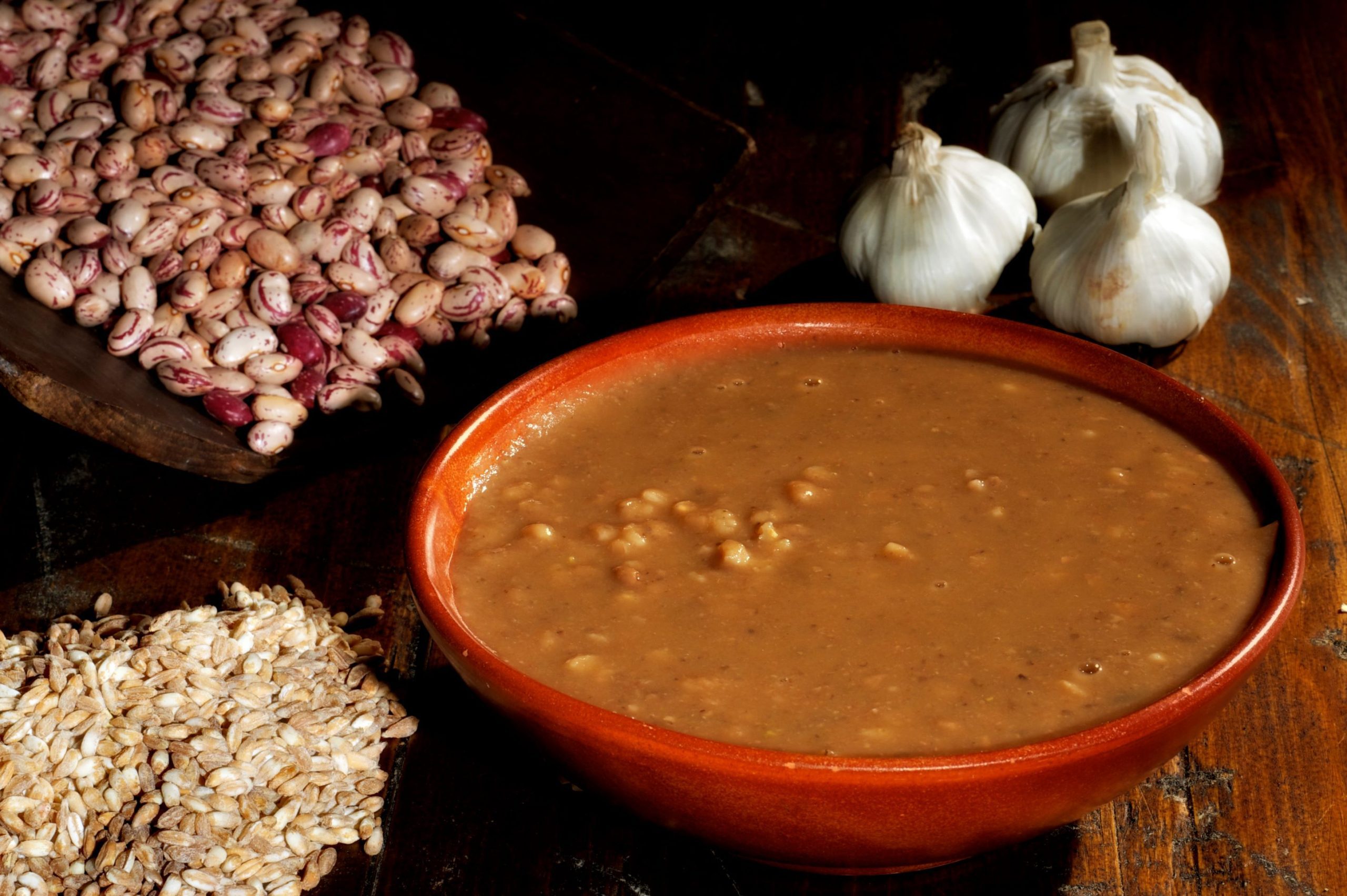
The Orrido di Botri Nature Reserve, in Bagni di Lucca, is a spectacular limestone gorge carved out by the waters. In the summer period, when the water flow is lower, it is possible to go up the final stretch. Visits are regulated in compliance with the ecological fragility of this environment which preserves more than 500 plant species.
he presence of a National Park, a Regional Park, numerous Nature Reserves and two UNESCO recognitions – the Geopark of the Apuan Alps and the MAB Biosphere Reserve of the Tuscan-Emilian Apennines – testifies to the rich environmental, naturalistic and historical heritage that characterizes the Garfagnana and the Serchio Valley.
Established in 1985, the Regional Park of the Apuan Alps includes the mountainous complex that extends for approximately thirty kilometers in a North-East, South-West direction parallel to the Tyrrhenian coast. The pyramidal cusp of Pisanino, with its 1947 m, is the highest peak of the chain, but each peak has its own shape that distinguishes it and its own legend, the traditions here are still strongly felt, spend a few days of holiday in one of the many small inhabited centers or simply walking along the paths marked by the CAI to reach a welcoming refuge near the top, can leave unique sensations, you can truly fall in love with these mountains.
Established in 2001, the Tuscan-Emilian Apennines National Park includes the Orecchiella Nature Reserves. The wooded ridges that separate Tuscany from Emilia Romagna give way to a true mountain environment. Here there are peaks that exceed 2000 metres, the forests give way to rocks, lakes and prairies. Further down, on the Emilian side, the Pania di Corfino stands out.
In 2015, UNESCO, recognizing the focal role of the Euro-Mediterranean climate frontier in this part of the northern Apennines, established the MAB (Man and the Biosphere) Reserve, for the Tuscan area the municipalities of Barga, Castelnuovo di Garfagnana, Castiglione di Garfagnana, Coreglia Antelminelli, Fosciandora, Minucciano, Piazza al Serchio, Pieve Fosciana, San Romano in Garfagnana, Sillano Giuncugnano, Villa Collemandina.
The Orrido di Botri Nature Reserve, in Bagni di Lucca, is a spectacular limestone gorge carved out by the waters. In the summer period, when the water flow is lower, it is possible to go up the final stretch. Visits are regulated in compliance with the ecological fragility of this environment which preserves more than 500 plant species.
Area Geopark Unesco
Total area: 20.598 hectares
Regional Park of the Apuan Alps
1 The park was established in 1985 with the aim of protecting the biodiversity, landscapes and geological resources of the Apuan Alps.
2 The entire rugged silhouette of the Apuan Alps has many other mountains to explore thanks to the network of trekking routes. Among these is the Pania della Croce, queen of the Apuan Alps, reachable with a panoramic excursion starting from Piglionico in the municipality of Molazzana. The peaks are not the only place to enjoy breathtaking views: from the pretty village of Careggine, a natural terrace overlooking the Apuan Alps, the view can get lost in the beauty of the surrounding peaks.
3 The natural arch that encloses the two peaks of Monte Forato with a circle is curious and evocative

Pisanino with its 1,946m is the highest peak in the Apuan Alps
Pisanino with its 1,946m is the highest peak in the Apuan Alps.
Area Geopark Unesco
Total area: 20,598 hectares
Regional Park of the Apuan Alps
1 The park was established in 1985 with the aim of protecting the biodiversity, landscapes and geological resources of the Apuan Alps.
2 The entire rugged silhouette of the Apuan Alps has many other mountains to explore thanks to the network of trekking routes. Among these is the Pania della Croce, queen of the Apuan Alps, reachable with a panoramic excursion starting from Piglionico in the municipality of Molazzana. The peaks are not the only place to enjoy breathtaking views: from the pretty village of Careggine, a natural terrace overlooking the Apuan Alps, the view can get lost in the beauty of the surrounding peaks.
3 The natural arch that encloses the two peaks of Monte Forato with a circle is curious and evocative
Monte Prado at 2,054 is the highest Apennine peak in Tuscany
MAB Unesco Reserve
Total area: 26.149 hectares
Tuscan-Emilian Apennines National Park
1 The National Park was established in 2001 to protect the ecological and landscape integrity of the Tuscan-Emilian Apennines.
2 The park is crossed by a dense network of hiking trails, including the Great Apennine Excursion and various thematic trails that cross environments of great naturalistic and historical value.
3 A territory where the golden eagle and the wolf find an ideal habitat, but also a territory where man has always lived with his traditional activities, agriculture, shepherd activity and forestation and to which he has added, in recent years, tourist reception.
Bagni di Lucca
Total area: 192 hectares
Orrido di Botri Nature Reserve
1 The Orrido di Botri Nature Reserve was established in 1971 with the aim of protecting the canyon and its unique habitats.
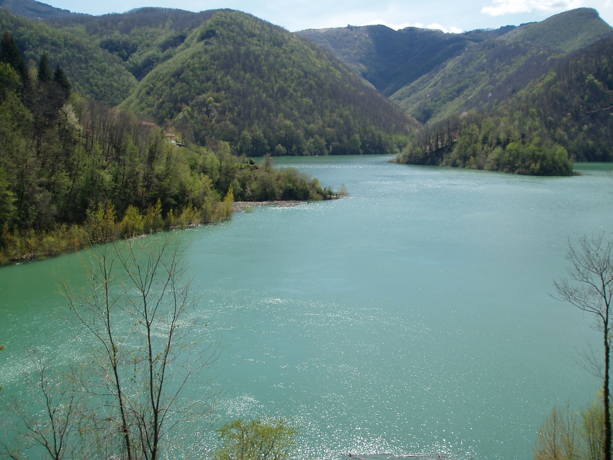
2 Mariana and Ribellino streams join into a single watercourse, first called Solco Grande and then Rio Pelago, creating a deep incision in the limestone rock. The Reserve protects the natural canyon and its walls, from an altitude of 634 m above sea level. to a maximum of 1334 m
3 The Botri Ravine is considered one of the most spectacular canyons of the Apennines and an important site of naturalistic interest for its biodiversity and its geological characteristics.
The Golden Eagle is the symbol of the wild and uncontaminated nature of the Orrido di Botri
The Golden Eagle is the symbol of the wild and uncontaminated nature of the Orrido di Botri
Bagni di Lucca
Total Area: 192 hectares
Orrido di Botri Nature Reserve
1 The Orrido di Botri Nature Reserve was established in 1971 with the aim of protecting the canyon and its unique habitats.
2 Mariana and Ribellino streams join into a single watercourse, first called Solco Grande and then Rio Pelago, creating a deep incision in the limestone rock. The Reserve protects the natural canyon and its walls, from an altitude of 634 m above sea level. to a maximum of 1334 m
3 The Botri Ravine is considered one of the most spectacular canyons of the Apennines and an important site of naturalistic interest for its biodiversity and its geological characteristics.
1
Do you like Nature?
The Garfagnana and the Serchio Valley preserve architectural jewels and naturalistic oases of inestimable value: finding them is the most beautiful quest.

Do you like nature?
The Garfagnana and the Serchio Valley preserve architectural jewels and naturalistic oases of inestimable value: finding them is the most beautiful quest.
Enjoy the mountains
Enjoy the mountains
Required maps
- Alpi Apuane meridionali fg. 535/537 scala 1:20.000 Ed. Mulgraphic – Firenze
- Alpi Apuane settentrionali fg. 534/536 scala 1:20.000 Ed. Mulgraphic – Firenze
- Appennino Tosco-Emiliano fg. 18 scala 1:20.000 Ed. Mulgraphic – Firenze
- Alpi Apuane fg 200 scala 1:25.000 Edizioni 4Land -Bolzano
- Appennino Tosco-Emiliano fg 208 scala 1:25.000 Edizioni 4Land -Bolzano
Per i percorsi in MTB:
- Carta turistica Garfagnana – Itinerari in MTB scala 1:50.000 ed. Ass Garfagnana MTB Sharing
The 10 Essentials for Mountain Safety
- Alpi Apuane meridionali fg. 535/537 scala 1:20.000 Ed. Mulgraphic – Firenze
- Alpi Apuane settentrionali fg. 534/536 scala 1:20.000 Ed. Mulgraphic – Firenze
- Appennino Tosco-Emiliano fg. 18 scala 1:20.000 Ed. Mulgraphic – Firenze
- Alpi Apuane fg 200 scala 1:25.000 Edizioni 4Land -Bolzano
- Appennino Tosco-Emiliano fg 208 scala 1:25.000 Edizioni 4Land -Bolzano
Per i percorsi in MTB:
- Carta turistica Garfagnana – Itinerari in MTB scala 1:50.000 ed. Ass Garfagnana MTB Sharing